
A Guide to Public Waterfront Access Points Across Ontario
Ontario has more than 250,000 lakes and countless rivers, but getting to the water legally is not always straightforward. Private property lines crowd many shorelines, boat launches fall into disrepair, and small municipal parks often go unadvertised. For paddlers, anglers, swimmers, and anyone who simply wants to sit beside the water, knowing where public access exists is half the battle.
This guide breaks down the types of public waterfront access available across the province, where to find them, and what to expect when you arrive.
Municipal Boat Launches
Most towns near water maintain at least one public boat launch. These range from paved, multi-lane ramps with floating docks to gravel pull-offs barely wide enough for a canoe. In cottage country, municipal launches often charge a daily or seasonal parking fee, typically between $10 and $50. Towns like Gravenhurst, Parry Sound, and Bracebridge maintain well-serviced launches that can handle larger trailer boats.
Smaller communities along Lake Huron, Lake Erie, and the inland lakes may have launches that are harder to find. They're often tucked at the ends of municipal road allowances, unmarked and unpaved. A good resource is the Ontario Ministry of Natural Resources recreation page, which includes information on public access points and Crown land areas open to the public.
Road Allowances and Unopened Road Ends
One of the least understood forms of public waterfront access is the road allowance. In Ontario's original land survey system, road allowances were laid out in a grid pattern across the province. Many of these survey roads were never built, but the Crown still holds title to the land. Where a road allowance meets a lake or river, the public theoretically has a right to access the water.
The practical reality is more complicated. Some road allowances have been obstructed by adjacent landowners, fenced off, or grown over with decades of vegetation. Others are well-used informal access points. The legality of using an unopened road allowance to reach the water is well established in Ontario law, but disputes with neighbouring property owners are common. If you encounter resistance, it's worth contacting the local municipality for clarification.
The ongoing tension between public and private shoreline access across Ontario has made road allowances a flashpoint in many lakeside communities.
Conservation Areas
Ontario's 36 conservation authorities manage hundreds of conservation areas, many of which include waterfront access. These range from day-use parks with beaches and picnic areas to more rugged sites with hiking trails and canoe launches. Most charge a daily vehicle fee of $5 to $15.
Conservation areas are among the best-maintained public access points in the province. Sites like Forks of the Credit, Elora Gorge, and Fifty Point on Lake Ontario offer excellent facilities. Smaller conservation areas along rivers and creeks often provide quieter access with fewer crowds. Check with your local conservation authority for a full list of properties open to the public.

Provincial Parks and Crown Land
Ontario's provincial parks provide guaranteed waterfront access, though a valid park permit is required. Day-use fees typically run $14 to $21 per vehicle. For paddlers and anglers, parks like Killbear, Grundy Lake, and Bon Echo offer excellent launch points with parking and basic facilities.
Crown land is perhaps the most underappreciated public access resource in Ontario. Roughly 87 percent of Ontario's land mass is Crown land, and much of it borders waterways. In northern and central Ontario, Crown land access points are plentiful. In southern Ontario, they're scarcer but still exist, particularly along the Canadian Shield fringe. You can camp on Crown land for free for up to 21 days in one location, making it an excellent base for waterfront camping adventures.
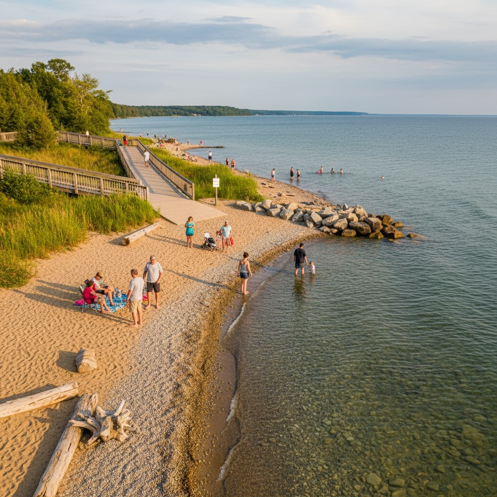
Municipal Parks and Waterfronts
Dozens of Ontario municipalities have invested in waterfront parks over the past two decades. Cobourg's beach and boardwalk, Kingston's waterfront trail, and Collingwood's harbour park are well-known examples. But smaller towns often have equally appealing waterfront parks that fly under the radar. Places like Port Dover, Goderich, Meaford, and Picton maintain public waterfronts with walking paths, benches, and water access.
Many of these overlooked riverfront parks are perfect for a quiet afternoon of fishing, birdwatching, or simply watching the water. They rarely appear in tourism marketing, but locals know them well.
Fishing Access Points
The Ontario government maintains a network of designated fishing access points, particularly along the Great Lakes and major tributaries. These sites are typically small, sometimes just a cleared path to the water with a small parking area. They're invaluable for shore anglers and can be found through the Ontario Fishing Regulations summary, which is updated annually.
Many of the best shore fishing spots in Ontario are accessible through these designated points. They're free to use, though you'll need a valid Ontario fishing licence.
Accessibility Considerations
Not all public access points are created equal when it comes to accessibility. Paved launches, barrier-free fishing platforms, and accessible trails are available at some locations but absent at many others. If mobility is a concern, the province's accessible waterfront spots are worth researching in advance. Several municipalities and conservation authorities have made significant upgrades in recent years, but progress remains uneven.
Finding Access Near You
The best approach to finding waterfront access combines online research with local knowledge. Municipal websites often list public parks and boat launches. Conservation authority websites map their properties. And sometimes, the best way to find an access point is to ask at a local bait shop or marina.
Public waterfront access is a shared resource. Treat it accordingly. Pack out your garbage, respect parking restrictions, and avoid blocking launch areas. The more responsibly these sites are used, the more likely municipalities are to maintain and expand them.