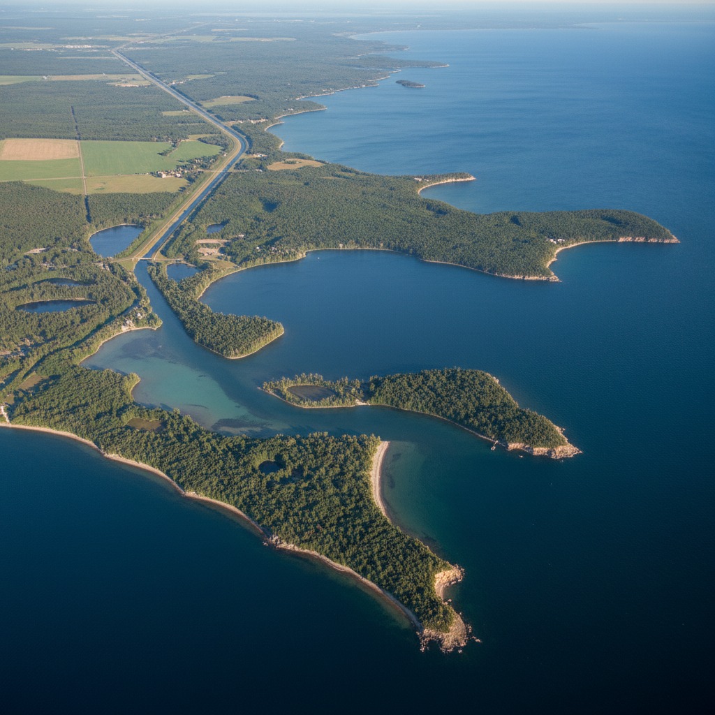
Climate Change and Fluctuating Water Levels on the Great Lakes
In 2013, Lake Huron and Lake Michigan hit their lowest recorded water levels. Docks sat high and dry on exposed lake bed. Marinas dredged channels just to keep boats afloat. Property owners on Georgian Bay watched their waterfront recede by dozens of metres. Six years later, those same lakes surged to all-time highs, swallowing beaches, flooding basements, and tearing apart seawalls that had stood for decades. The Great Lakes, it turns out, are not the stable bodies of water most people assume them to be.
This extreme oscillation, from historic lows to record highs and back, has become the defining hydrological story of the Great Lakes in the 21st century. And while water levels have always fluctuated on these inland seas, climate scientists are now confident that the amplitude and speed of those swings are being amplified by a changing climate.
The Mechanics Behind the Swings
Great Lakes water levels are governed by a relatively simple equation: precipitation and runoff flowing in, evaporation and outflow draining out. The balance between these forces determines whether levels rise or fall in any given year. Climate change is disrupting both sides of this equation simultaneously.
Warmer air temperatures mean warmer lake surface temperatures, which should theoretically increase evaporation and lower levels. That is exactly what happened during the low-water period of 2012 to 2013. But warmer air also holds more moisture, and the Great Lakes region has seen a measurable increase in annual precipitation since the 1950s. When heavy rain events intensify, as climate models predict and recent data confirms, runoff into the lakes overwhelms evaporative losses.
Ice cover adds another variable. The Great Lakes historically froze over 40 to 60 percent of their surface area each winter. That ice cap acts as a lid, preventing evaporation during the cold months. As winters warm, ice coverage has declined sharply. During the winter of 2023, Lake Erie's ice cover peaked at just 12 percent. Less ice means more winter evaporation, which should push levels down. But reduced ice also means open water absorbs more solar radiation, warming earlier in spring and potentially fuelling more intense precipitation cycles. According to data from NOAA's Great Lakes Environmental Research Laboratory, average ice coverage has decreased by roughly 70 percent since the early 1970s.
What High Water Means for Shorelines
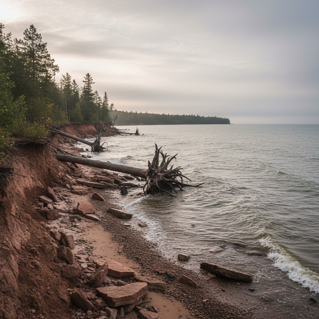
The high-water period from 2017 to 2020 offered a preview of what shoreline communities can expect when levels surge. Along the Lake Huron coast, waves driven by fall storms carved into bluffs at rates exceeding one metre per year. Cottages that had sat safely 30 metres from the bluff edge found themselves perched above crumbling clay walls. Municipal roads in lakeshore communities like Bayfield and Point Clark buckled as saturated ground lost its structural integrity.
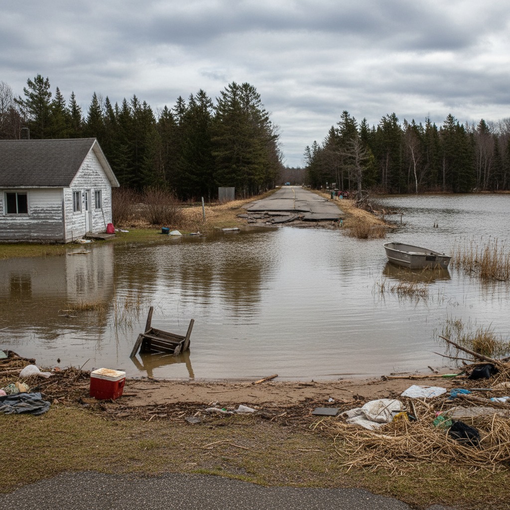
Infrastructure designed for average conditions proved hopelessly inadequate. Breakwalls engineered to withstand waves at normal lake levels were overtopped and undermined by the higher water. Storm sewer outfalls that relied on gravity drainage backed up when lake levels exceeded their elevation. Septic systems in low-lying areas failed as water tables rose, contaminating nearshore waters with untreated effluent.
The economic toll was staggering. A 2020 report by the International Joint Commission estimated that high water levels caused over $1 billion in damages along the Canadian shores of the Great Lakes between 2017 and 2019. Municipalities scrambled to find emergency funding for shoreline protection, and many river towns that bear the brunt of spring flooding found themselves dealing with dual crises as both lake and river levels rose simultaneously.
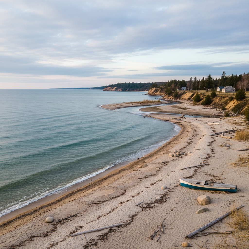
Low Water Brings Different Problems
Low water, while less dramatic in its visual impact, carries its own set of consequences. Marina operators lose revenue when harbours become too shallow for recreational boats. Municipal water intakes that draw from the lakes can find themselves exposed or pulling from warmer, shallower water that is more susceptible to algal blooms. Wetlands that depend on seasonal flooding to maintain their ecology dry out, reducing habitat for fish, amphibians, and migratory birds.
Commercial shipping on the Great Lakes is particularly sensitive to water depth. Every inch of lost draft costs a lake freighter roughly 270 tonnes of carrying capacity. During the low-water years of the early 2010s, shipping companies routinely loaded vessels below capacity to avoid running aground, raising transportation costs for everything from iron ore to grain.
Adapting to the New Normal
The uncomfortable truth for anyone living along the Great Lakes is that the era of relatively stable water levels may be over. Climate models project continued increases in both precipitation intensity and evaporation rates, suggesting that the wild swings of the past decade could become the new normal.
Some communities are already adapting. Municipalities in vulnerable areas have updated their official plans to establish wider setback requirements for new construction near the water. Conservation authorities are promoting the restoration of riparian buffers and natural shoreline vegetation as a first line of defence against erosion. The concept of "managed retreat," voluntarily moving structures and infrastructure away from eroding shorelines, has entered planning discussions in several Ontario communities, though it remains politically contentious.
Individual property owners face difficult decisions. Investing in hard shoreline protection like armour stone or steel sheet piling can cost $1,000 or more per linear metre, and there is no guarantee the engineering will hold against conditions that exceed its design parameters. Softer approaches, including naturalized shorelines with native plantings and strategic grading, offer more flexibility but require ongoing maintenance. Understanding how ice damage affects shoreline structures is also essential for anyone considering protection investments.
What is certain is that the Great Lakes will continue to surprise. The system's enormous thermal mass and complex hydrology make precise predictions difficult, even with improving climate models. Communities that plan for a range of scenarios, from extreme lows to record highs, will be far better positioned than those that simply react to whatever the lakes throw at them next.