Life Along the Georgian Bay Shoreline
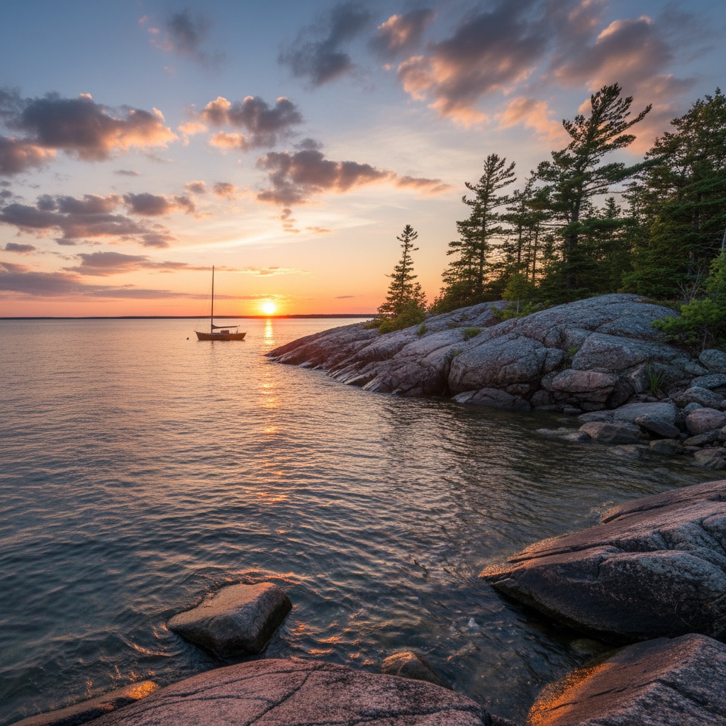
Georgian Bay does not look like the rest of Ontario's waterfront. The southern shore, from Collingwood through Wasaga Beach, has sandy beaches and gentle topography. But swing north and east around the bay, and the landscape transforms completely. The Canadian Shield pushes to the water's edge. Windswept pines cling to bare rock. The shoreline fractures into thousands of islands, channels, and inlets that together form one of the most complex coastal environments on the continent.
Living along this shoreline means something different depending on where you are. The communities that line Georgian Bay range from the busy recreational hubs of Collingwood and Midland to the quiet shield-country settlements of Pointe au Baril and Killarney. Each has developed its own relationship with the water, shaped by geography, history, and the particular character of the bay at that point.
The Southern Shore: Accessible and Growing
The southern Georgian Bay shore is the most developed section. Collingwood, Thornbury, and Meaford form a corridor of communities that has grown significantly over the past two decades. The draw is straightforward: proximity to Toronto (under two hours), four-season recreation, and a waterfront setting that combines beach access with mountain landscapes at Blue Mountain.
Collingwood's transformation from a shipbuilding town to a recreation and retirement destination is one of Ontario's most studied community reinventions. The old shipyard lands became the waterfront district, with condos, a rebuilt harbour, and a trail system that connects to the broader Georgian Trail network. The town's permanent population has nearly doubled since 2000, and the construction cranes that dot the skyline suggest the growth is far from finished.
Thornbury, a few kilometres west, has maintained a smaller scale. The harbour, the restored fishway on the Beaver River, and the compact downtown give it a village feel that Collingwood has largely outgrown. Meaford, further along the coast, is earlier in its growth arc, with lower property prices and a quieter pace that appeals to those who find Collingwood too busy.
The challenges on the southern shore are familiar ones: housing affordability pressures, infrastructure strain, and the tension between growth and character. What makes them specific to Georgian Bay is the environmental sensitivity of the shoreline. The bay's water quality depends on managing stormwater runoff, sewage treatment, and shoreline development across dozens of municipalities, and coordination among those municipalities has been inconsistent.
Midland, Penetanguishene, and the Thirty Thousand Islands
The eastern shore of Georgian Bay, centered on Midland and Penetanguishene, has a different character. These are historically significant communities, tied to the fur trade, to military history at Fort Ste. Marie and Discovery Harbour, and to the region's Indigenous heritage. The Sainte-Marie Among the Hurons historic site draws visitors from across the country, and its presence gives the area a cultural depth that pure recreation communities lack.
Midland's waterfront has been the focus of revitalization efforts for years. The town dock, the murals program, and the harbour walk create a public waterfront that works well during the summer months. Penetanguishene, at the head of its own bay, has a quieter, more local-serving waterfront anchored by the town dock and the surrounding restaurants.
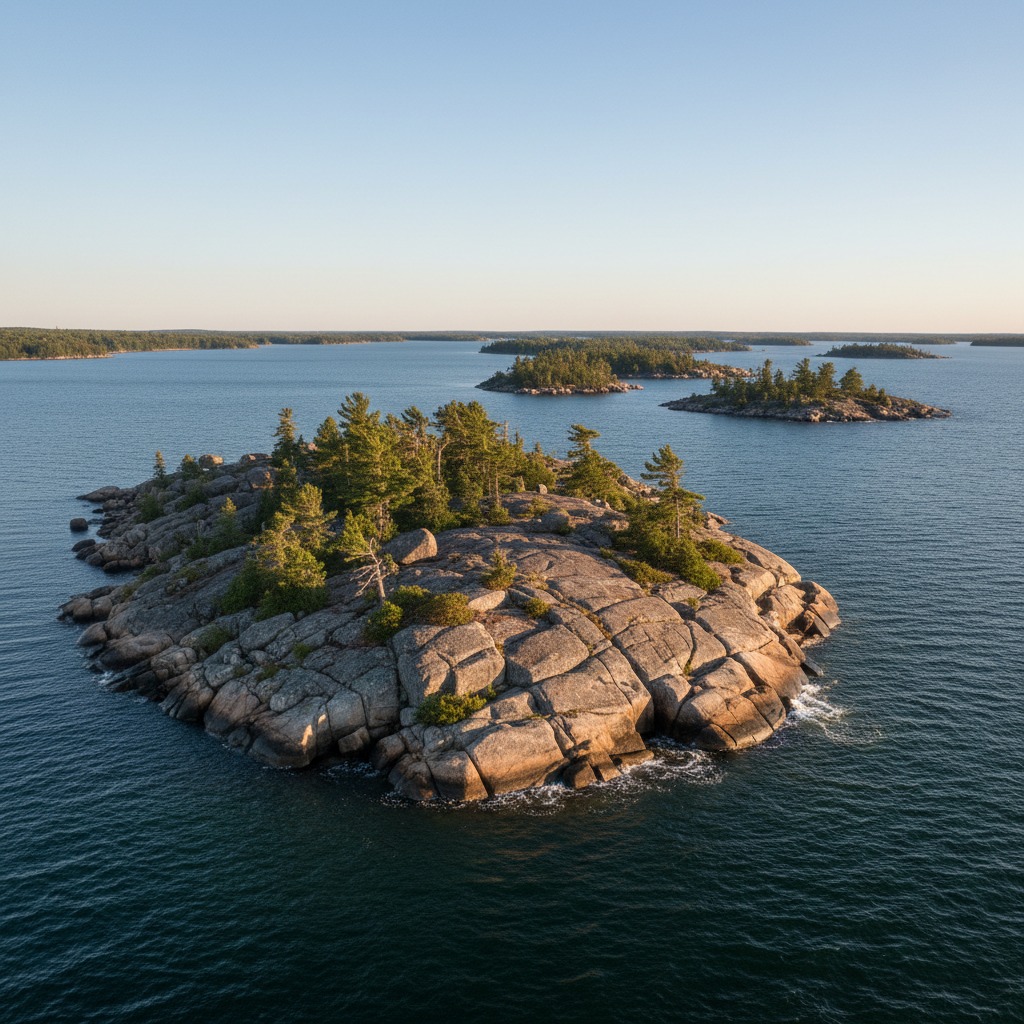
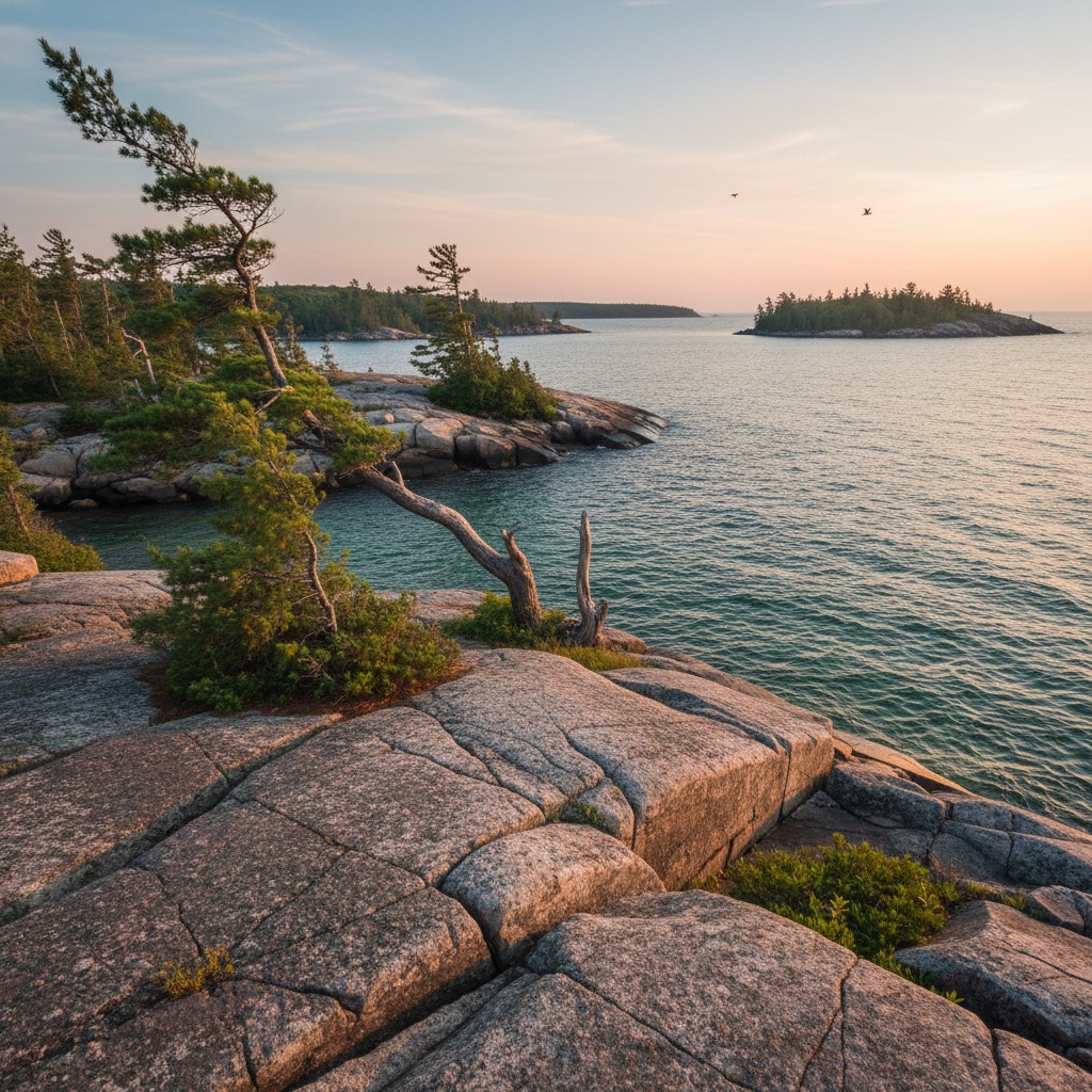
Beyond the towns, the Thirty Thousand Islands stretch north along the bay. This is the Georgian Bay of Group of Seven paintings: bare rock, twisted pines, deep channels, and water that turns from turquoise to black within metres as the bottom drops away. The communities here are mostly seasonal, accessed by boat, and governed by a fierce attachment to the landscape that makes any development proposal contentious.
Parry Sound and the Northern Shore
Parry Sound sits at the geographic centre of Georgian Bay's eastern coast. The town's deep natural harbour has made it a marine hub for over a century. Today, it is the departure point for the Island Queen cruise through the Thirty Thousand Islands and a gateway for cottagers heading to properties on the outer islands.
The town itself has a working-class character that distinguishes it from the southern shore's recreation-oriented communities. The harbour is functional rather than picturesque. The downtown serves locals rather than tourists. The affordability is better, and the pace is noticeably slower. For people priced out of Collingwood or Muskoka, Parry Sound offers a waterfront lifestyle at a fraction of the cost.
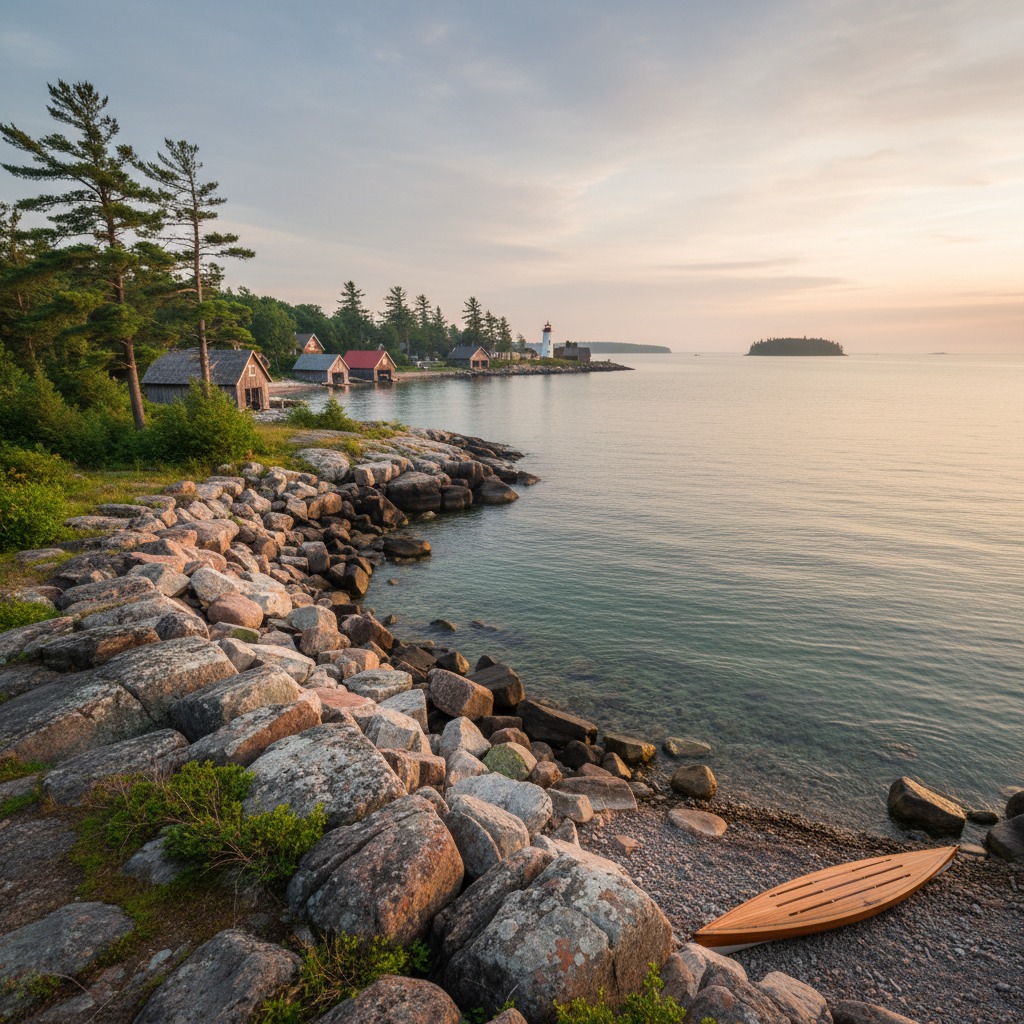
Further north, the communities thin out. Pointe au Baril is a collection of cottages and a general store on the water, reachable by a winding road through shield country. Killarney, at the northern edge of Georgian Bay, is a fishing village turned artists' colony, famous for its white quartzite mountains and its position as the gateway to Killarney Provincial Park.
The Environmental Picture
Georgian Bay's ecology is distinct from the lower Great Lakes. The water is clearer, colder, and less nutrient-rich. The shoreline habitats support species that do not occur further south, including the eastern massasauga rattlesnake, which is listed as threatened under the federal Species at Risk Act. The bay's wetlands, particularly in the southeastern marshes around Matchedash Bay and Wye Marsh, are critical for migratory birds and fish spawning.
The environmental pressures are cumulative rather than catastrophic. Cottage development on the islands increases runoff. Boat traffic stirs up sediment in shallow channels. Invasive species, particularly the round goby and phragmites, are altering nearshore ecosystems. The Georgian Bay Forever organization has been instrumental in monitoring water quality and advocating for science-based management, but the challenges are growing.
Water levels on Georgian Bay fluctuate with the broader Lake Huron system, and the bay experienced near-record highs in 2019 and 2020 that caused significant shoreline damage. The subsequent drop has left some docks and boat launches high and dry. This volatility makes planning difficult for communities whose infrastructure is built to a specific water level that the bay no longer reliably maintains.
What Holds It Together
For all the differences between Collingwood and Killarney, between Midland and Pointe au Baril, Georgian Bay communities share something fundamental: a sense that the water is not just a feature of the landscape but the defining one. People who live along the bay orient their lives around it. They check the weather forecast differently. They know the wind directions and what each one means for their stretch of shore. They track water levels the way farmers track rainfall.
That connection creates a kind of community solidarity that transcends municipal boundaries. When Lake Simcoe faces ecological pressure or harbour towns debate development, Georgian Bay residents pay attention, because the issues are interconnected. The health of the bay depends on decisions made far upstream and in municipal offices across the region. Living on Georgian Bay means understanding that the waterfront is not a private amenity. It is a shared responsibility.